Best Motorcycle Rides Near Tampa 2026: Swamp Routes, Coastal Roads and Hidden Back Roads
Apr 5, 2026
Tags:tampa-flroutesrenterfloridafl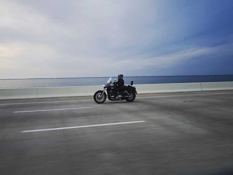
The best motorcycle roads in Tampa, Florida aren’t the ones you see on a map at first glance. They’re the roads that start to open up once traffic thins out, where you can hold a steady pace without constantly checking your mirrors. One ride takes you deep into the Green Swamp, another runs straight out toward the Gulf on the Ozello Trail, and both feel nothing like the city you just left.
What are the Best Motorcycle Rides near Tampa, Florida?
- Green Swamp Encounter (77 mi, ~3 hrs)
- Ozello Trail (20 mi out-and-back, ~1.5 hrs)
- Tail of the Gecko (~25 mi core, extendable to 100+)
- Sunshine Skyway Secrets Route (75 mi, ~3 hrs)
- Sugarloaf Mountain Loop (~35 mi, ~2 hrs)
- North Tampa Circuit (82 mi, ~2.5 hrs)
- Lithia Pinecrest Loop (79 mi, ~2.5 hrs)
- Over the River and Through the Woods Loop (129 mi, ~5 hrs)
1. Green Swamp Encounter
Start: I-75 and Highway 50, 30 miles northeast of Tampa
End: Zephyrhills, FL
Approximate miles: 77 miles, about 3 hours
The Green Swamp Encounter runs 77 miles through the Green Swamp Wilderness Preserve, a 560,000-acre protected watershed where the Withlacoochee, Hillsborough, Oklawaha, and Peace Rivers all start. The corners on Rockridge Road are the part most Tampa riders come out here for, and Highway 33 and Green Pond Road connect them into a full loop that ends in Zephyrhills about three hours later.
What’s the Green Swamp motorcycle route?
The Green Swamp motorcycle ride is one of the oldest established motorcycle loops in central Florida, originally mapped in the 1970s and still the go-to day ride for riders based out of Tampa, Lakeland, and Orlando. The route is rideable year-round, though October through May runs cleanest with humidity below 60% and temperatures in the 60s and 70s. Expect 8 to 12 moderate-grade corners on Rockridge Road and Green Pond Road, with almost no traffic on weekdays.
Skill level and timing
- Skill level: Intermediate, mainly for the rough pavement on Old Dade City Road
- Best time of day: Opt for morning starts in summer since storms hit after 2 p.m.
- Best time of year: October through May for low humidity and minimal storm days
- Traffic: Almost none on weekdays, light on weekends
NOTE: There's no fuel between Highway 50 and Zephyrhills (a 45-mile gap) and pavement on Old Dade City Road before Highway 98 gets rough enough that you'll want to drop your speed before you hit it.
2. Ozello Trail
Start: US 19 at SR 494, 60 miles north of Tampa
End: Ozello Community Park, Crystal River, FL
Approximate miles: 9 miles one way, 20 miles out-and-back
The Ozello Trail is a 9-mile run along State Road 494 that peels off US 19 north of Homosassa Springs and dead-ends at Ozello Community Park on the Gulf of Mexico. The road cuts through Crystal River Preserve State Park along the salt marshes, with three short bridges over tidal creeks on the way out. The corners in the middle two miles are the tightest you'll find on any paved road in peninsular Florida.
How far is the Ozello Trail from Tampa?
The Ozello Trail motorcycle ride sits 60 miles north of Tampa, which works out to about a 75-minute run up US 19. Riders from Tampa, Orlando, and Jacksonville have been running this road since the mid-1990s, and it's held its reputation as the state's top paved twisty ever since. Expect around 14 corners in the 9-mile section with reverse-banked turns in the middle that catch newer riders off guard.
Skill level and timing
- Skill level: Intermediate minimum because of the reverse-banked corners between miles 4 and 6
- Best time of day: Mornings before 10 a.m., afternoons bring weekend riders and storm risk in summer
- Best time of year: October through May for dry pavement and lower humidity
- Traffic: Light on weekday mornings, heavier on weekend afternoons with regulars running the road back-to-back
NOTE: The first two miles after US 19 pick up gravel from the side roads connecting to SR 494. Ride those miles expecting loose rock on the pavement until you're past the salt marsh tree line.
3. Tail of the Gecko
Start: SR 62 and Jameson Road, 30 to 40 miles southeast of Tampa
End: CR 672 or CR 674, or loop back through Balm and Wimauma
Approximate miles: 25 miles core, extendable to 100+
Locals named this one after the Tail of the Dragon in the Smokies, which gives you an idea of what Hillsborough and Manatee County riders think of it. The core ride runs 25 miles between SR 62 and CR 672, and the best corners hit early on the northbound run before the road drops to a single lane lined with live oak. Nobody really drives out here just for the 25 miles, so Tampa riders tie it into a loop through Balm, Wimauma, and Sun City Center that pushes the day closer to 100.
Are there twisty roads near Tampa for motorcycles?
The Tail of the Gecko is as close as it gets, sitting about 30 miles southeast of downtown Tampa between SR 62 and CR 672. You get around 8 tight corners packed into a 6-mile section, which is why Hillsborough County riders have kept this one on their regular rotation for years. If you want sharper corners and don't mind the drive, the Ozello Trail and Sugarloaf Mountain Loop both deliver more.
Skill level and timing
- Skill level: Intermediate because of the single-lane pavement and no center line
- Best time of day: Weekend mornings to beat the farm traffic, anytime on weekdays
- Best time of year: October through May, summer storms move through this area fast
- Traffic: Light overall, though weekends bring tractors and horse trailers on the farm roads
NOTE: The single-lane section between Jameson Road and CR 39 has no center line and the sightlines drop around the shaded corners. Expect oncoming traffic to drift into your lane on the tighter turns.
4. Sunshine Skyway Secrets Route
Start: I-275 South at the north approach to the Sunshine Skyway Bridge, 25 miles south of Tampa
End: Fort De Soto Park, or return via I-275 North
Approximate miles: 75 miles, about 3 hours
This ride is built around the Sunshine Skyway, which climbs 430 feet over Tampa Bay at its highest point and delivers the kind of 4-mile crossing you remember long after the rest of the day blurs together. Once you're through the south toll booth, the route peels off US 19 onto the mangrove-lined county roads through Terra Ceia, and that's the part most riders don't find on their own. The loop finishes at Fort De Soto Park with food trucks running along East Beach Road through the afternoon.
Skill level and timing
- Skill level: Beginner-friendly on the bridge itself, intermediate on the backroads because of the narrow mangrove sections
- Best time of day: Before 10 a.m. for the lightest wind and clearest visibility across the bay
- Best time of year: November through April for the steadiest wind conditions
- Traffic: Light on weekday mornings, heavier on weekend afternoons with beach traffic through Fort De Soto
NOTE: Crosswinds above 25 mph push lighter bikes around on the upper span, so check the marine forecast before the ride and keep both hands planted through the tallest section. The motorcycle toll is $1.75 each way via SunPass or cash.
5. Sugarloaf Mountain Loop
Start: Clermont, FL, 90 minutes northeast of Tampa
End: Clermont, FL (loop)
Approximate miles: 35 miles, 1.5 to 2 hours
Sugarloaf Mountain sits at 312 feet, which sounds like nothing until you're on CR 561 working up a 14% grade that shouldn't exist this far south in Florida. The 35-mile loop runs through Lake County citrus groves and horse farms, tying CR 561 and CR 455 together into one of the few Florida rides with actual elevation changes to plan around. On a clear morning, the view from the top reaches east across Lake Apopka to the Orlando skyline.
Skill level and timing
- Skill level: Intermediate, mainly because of the tight turns on CR 455 and the steep climb
- Best time of day: Weekday mornings, weekend cyclist traffic on CR 561 slows the pace
- Best time of year: October through May for cooler temperatures
- Traffic: Light on weekdays, heavy on weekends with cyclists and sport bike riders on the loop together
NOTE: Some of the side roads branching off CR 561 and CR 455 turn to rough pavement quickly. Stick to the two main county roads if you're on a sport bike or anything with limited ground clearance.
6. North Tampa Circuit
Start: SR 54 and Collier Parkway, Land O' Lakes, 25 miles north of Tampa
End: SR 54 and Collier Parkway (loop)
Approximate miles: 82 miles, about 2.5 hours
The North Tampa Circuit is the easiest way to log a half-day of back-road riding without having to deal with anything as steep as Sugarloaf or as tight as Ozello. The 82-mile loop runs through Brooksville, Trilby, Dade City, and Zephyrhills, with a few low hills near Brooksville breaking up the flat ranch country. Pavement holds up well through the whole loop, and traffic stays light enough that newer riders can ease into a steady pace.
Skill level and timing
- Skill level: Beginner-friendly through the full loop
- Best time of day: Mornings before the Dade City farm stands get busy on weekends
- Best time of year: October through May, summer afternoons bring storms through this area
- Traffic: Light on weekdays, moderate on weekends with farm stand and antique shop traffic in Dade City
NOTE: Fuel and food only show up in Dade City and Zephyrhills on the back half of the loop, so fill the tank in Land O' Lakes before you head north.
7. Lithia Pinecrest Loop
Start: Lithia Pinecrest Road, 20 miles southeast of Tampa
End: Lithia Pinecrest Road (loop)
Approximate miles: 79 miles, about 2.5 hours
The Lithia Pinecrest Loop runs 79 miles through lakes, orange groves, and the farmland south of Brandon, with the TECO Gasifier tower off Route 39 standing out as the one thing you won't see on any other ride in Florida. Pavement holds up well on Lithia Pinecrest Road and Route 674, though a few rough patches turn up between Route 39 and Route 674 near the grove access roads. What you'll notice out here that the North Tampa Circuit doesn't hand you is the wildlife, with deer, hogs, and alligators crossing often enough that dawn and dusk rides need a slower pace.
Skill level and timing
- Skill level: Beginner-friendly through about 90% of the loop
- Best time of day: Mid-morning or mid-afternoon to avoid peak wildlife crossing times
- Best time of year: October through May for cooler riding and lower humidity
- Traffic: Light across the full loop, weekdays and weekends both
NOTE: The only fuel stops on this loop are in Lithia at the start, a single station near Route 39 at the midpoint, and back in Lithia at the end. The 30-mile gap between the midpoint and the end is the longest, so plan around it.
8. Over the River and Through the Woods Loop
Start: Hungry Harry's Famous BBQ on Route 41, 30 miles north of Tampa
End: Hungry Harry's Famous BBQ (loop)
Approximate miles: 129 miles, 4 to 5 hours
The Over the River and Through the Woods Loop is the longest ride on this list at 129 miles. The route runs through Withlacoochee State Forest and the Green Swamp Preserve, with San Antonio and the ranch country around it sitting between the two forested sections. You'll recognize pieces of it from other rides, with the forest cover similar to the Green Swamp Encounter and the ranchland close to what the North Tampa Circuit runs. Hungry Harry's on Route 41 is where most riders start and finish the day.
Skill level and timing
- Skill level: Intermediate, mainly because of the 129-mile distance and sun exposure on the open sections
- Best time of day: Early start, ideally rolling out of Hungry Harry's by 8 a.m.
- Best time of year: October through May, summer afternoons bring storms on the eastern leg
- Traffic: Light on weekdays, moderate on weekends around San Antonio
NOTE: Summer storms hit the eastern leg hardest between 2 and 5 p.m. Ride through that section before early afternoon if you can. Our motorcycle trip packing list covers what to bring for a full-day ride like this one.

| Route | Miles | Difficulty | Best Season | Highlights |
|---|---|---|---|---|
| Green Swamp Encounter | 77 | Intermediate | October through May | Four-river headwaters, Rockridge Road corners, near-empty weekday pavement |
| Ozello Trail | 20 | Intermediate | October through May | 14 corners in 9 miles, Gulf of Mexico dead-end, state's top paved twisty |
| Tail of the Gecko | 25+ | Intermediate | October through May | Florida's answer to the Tail of the Dragon, 8 tight corners in 6 miles, single-lane canopy |
| Sunshine Skyway Secrets Route | 75 | Beginner to Intermediate | November through April | 430-foot bridge climb, 4-mile Tampa Bay crossing, Terra Ceia backroads |
| Sugarloaf Mountain Loop | 35 | Intermediate | October through May | 312-foot peak (highest on the Florida peninsula), 14% grade on Sugarloaf Road, Lake Apopka views |
| North Tampa Circuit | 82 | Beginner | October through May | Ranch country and small-town Florida, low hills near Brooksville, easy pavement throughout |
| Lithia Pinecrest Loop | 79 | Beginner | October through May | TECO Gasifier tower, orange grove roads, wildlife crossings |
| Over the River and Through the Woods Loop | 129 | Intermediate | October through May | Withlacoochee State Forest, Green Swamp Preserve, longest ride on the list |
Explore These Routes in Tampa with a Motorcycle Rental from Riders Share
Riders Share has 65+ motorcycle rentals in Tampa and 455+ across Florida, with local owners renting everything from cruisers to adventure bikes at daily rates below shop pricing. Pick the bike that fits the ride, book it, and you'll be on some of the best Florida motorcycle routes Tampa has the same day. Browse motorcycle rentals in Tampa to find your bike.

Looking to ride outside the Tampa area? Our guide to Florida's best motorcycle rides covers routes across the state, from the Keys to the Panhandle and everything in between.
Related Articles
Mon - Fri: 8-8 CT
Weekends: 9-8 CT
